Happy Trails: Josephine Peak Road by @askewcycling
HAPPY TRAILS: JOSEPHINE PEAK ROAD

I have a crazy work schedule, which can be normal in Los Angeles. I’ll work nonstop - six days a week for a long stretch then have no work for a month or two. Right now, l’m on a nights and weekends schedule, which lets me ride midday, midweek.
Midday, midweek rides can make it difficult to find riding partners but…if you seek solitude in mountains that are located next to 18.5 million people (the Greater LA area) then you’ll be the envy of all your friends.

I fall into this schedule a few times a year. Most recently, it was during the Summer, which made for some very hot rides. I would normally be found in the canyons searching for shade and water, riding in my sandals while taking hand fulls of salt pills to keep from cramping. Luckily, the weather right now in Los Angeles, more specifically, the San Gabriel Mountains, is prime for midday adventures…. as long as you bring a layer or two.

Since the weather is so nice, I’ve been trying to hit up some of the classic climbs in the front range that I would never attempt in Summer. Today as I drove up the 2 looking for inspiration on where to go and what to ride, I noticed there was only a single car parked at Clear Creek. Now if this was the weekend, the intersection of Angeles Forest Highway and Angels Crest Highway would be packed with parked cars and all the fun places to ride, full of trail users…. But it’s Tuesday at 10:00am.

It has been almost two years since I’ve ridden up to Josephine Peak (the last time, it snowed on me). I parked, packed up my snacks and figured out what I was going to wear. Now since, I headed up the Crest without a particular destination in mind and without checking the forecast, I just threw a bunch of riding clothes in the car.

It was a little cold in the shade (rock shade, there aren’t very many trees there) and cool in the sun, which I knew would make for a moderate climb but I’d get cold if I stopped. I decided on long sleeves, my Lowe Tech L/S shirt is quickly becoming my favorite shirt in these conditions. I also threw my Dravus jacket and some gloves in my frame bag for the ride down. After a few very cold descents years ago, I pretty much always bring a packable jacket on any ride that is remotely cold. I also wore knickers and work boots, because I’m weird like that.
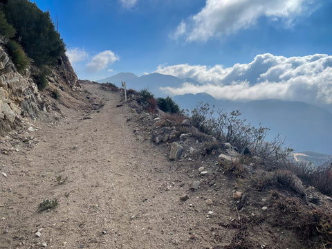
Josephine Peak Road, which is a pretty well maintained fire road that snakes up the mountain for awhile… it’s actually quite the climb. I don’t know the ride numbers, I stopped using Strava once I realized how unhealthy it was for me. That said, it’s like 4 miles up with 2,000’ of elevation then back down. I was out for a 2.5 hours, a leisurely outing with lots of stops, happy to be on my hardtail and it’s 28x50 granny gear. I’ve also ridden up it on a gravel bike and a rigid MTB as part of a longer ride.

There are two reasons to ride up Josephine Peak Road, one is for the views (today did not disappoint) and, two, if you’re a hardy singletrack-loving mountain biker who doesn’t mind (a lot of) exposure who wants to ride the Strawberry Peak Loop. With my time constraints for the day, I was there for the views (and exercise).

My favorite view is Strawberry Peak, which is almost always present in the background. Facing the other direction, you can see downtown LA, 17 miles away. On a real clear day you can see the Pacific. That, plus Mt Lukens (the highest point of the City of Los Angeles at 5,075’) is what makes LA have the largest elevation difference of any city in the country. Today, Lukens was shrouded in clouds.

I slowly made my way up the road stopping to rest…I mean…to take photos at a few places where the road switches back to present a perfect photo spot to capture your riding companions (or empty trail for me). You get to see the road below so often that riding up on a big group ride or during something like the LA Tourist Race is quite the sight.

The main climb reaches up to the saddle between Josephine and Strawberry. The Strawberry Peak Loop trail turns off to the right and Josephine Road continues to the left on the backside of the mountain, giving you a view of the other side of the San Gabriel’s, including Mt Gleason and Mt Pacifico.

The last stretch of the climb always seems longer than you expect but also a little surprising when you reach the end of the road with its abruptness. There’s little trail to the top of the peak, which you’ll need to hike-a-bike up. The top isn’t very big but there are a few nice places to have a snack and enjoy the view.

After watching the clouds move up and down the surrounding peaks, eating my snacks and taking a few photos, I headed back down, happy to have a jacket and gloves.

Descending in the San Gabriel’s can be tricky. I much prefer the singletrack in the area, because the fire roads (technically, access roads or double track but whatever) tend to be off camber hard-pack with a sprinkling of marble-like gravel on top that drops you at great speed into sandy corners and deep ruts. My hardest falls were on similar roads (Mendenhall Ridge Road and Santa Clara Divide Road), I now tend to descend them carefully. Don’t forget your bell and @benicesayhi because, if it isn’t the weekend, you’ll meet more than a few Angelenos.

